View from Maison Dupic down Rue Emile Desourteaux
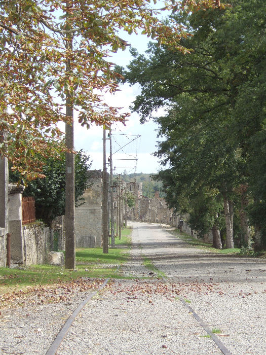
The Maison Dupic, used by the SS as a base during Saturday night and which was the last house to be burnt (on Sunday 11th June), is to the left of this view down the Rue Emile Desourteaux. This marks the northern limit of the ruins and was the second entrance to them before the Centre de la Mémoire opened in April 1999. You can clearly see that the main road rises as it runs through the village and that the northern end is higher than the southern where the church is located. The first house at the northern end of the village is just visible on the left of view and the church steeple can be seen in the distance at the end of the road, in line with the tram tracks and overhead wires. The telephone kiosk is just visible on the right, past the Post Office. This picture was taken in November 2006 and Horse Chestnuts can be seen lying on the ground where they have fallen from the trees.
© Michael Williams: revised February 2022