Village map of Oradour-sur-Glane new village
Village map of Oradour-sur-Glane ruins
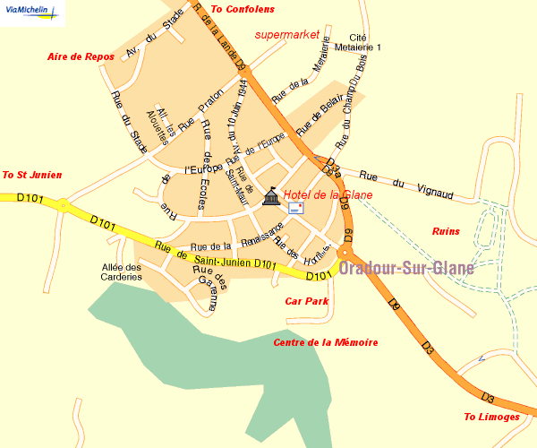
This map is based on the Via Michelin map of the Oradour area and has been modified to show the locations of the Centre de la Mémoire, its car park and the Aire de Repos at the end of the Rue du Stade (which can be used by Motorcaravans free of charge). It is worth noting that there is a small supermarket off the roundabout on the Rue de la Lande (the D9). The Hotel de la Glane is between the Town Hall and the Post Office. For a satellite view of Oradour-sur-Glane, take a look at either Google Maps, or Bing Maps (the Microsoft version), the ruins are clearly visible from space; as is the Aire de Repos.
Original map above courtesy of Michelin
© Michael Williams: revised July 2009